Top 10 Places You Can't See on Google Maps! It’s meant to give us a global view of our entire world – but it appears that there are some places that we aren’t meant to see. Here are 10 places that remain a mystery… for now.
Number 10: Junction Ranch
Our first stop is in the middle of the Mohave Desert in California, USA. Zoom in and you might think that you can see all there is to see – this army testing site features military vehicles, some sort of runway, and a series of strange geometrical patterns built into the ground. But when you get in closer, you will see that not everything is on display.
Number 9: The Faroe Islands
This self-governing group of islands off the coast of Denmark is made up of 18 volcanic islands and a few inexplicable black-green smudges, if you are to believe Google Earth.
Some people think that the murky sections are hiding an old World War 2 military base – but in this case, the conspiracy theories are trumped by the more likely explanation that some obscure fishing rights laws are to blame.
Number 8: Tantauco National Park
This one is a complete mystery. This national park in Chile is open to the public and even has two camping grounds, but from Google Earth the area looks blurry, blocky and hidden. Why? No one knows, but perhaps it has something to do with the endangered animal species that call the Tantauco National Park home.
Number 7: Portlaoise Prison
Home to members of several illegal paramilitary organizations along with fighters from the Provisional Irish Republican Army – AKA the IRA – this prison is about as high security as it gets. There’s a strict no-fly over rule in operation, an army detachment from the Irish Defense Force running security, and a 10-year-old satellite photo on Google Maps where the real prison should be. Hey, every little bit counts, right?
Number 6: The Michael Auf Building
We’re back to the US, and we’re back to more supposed military testing facilities. This one, the Michael Auf Building in Utah, is said to be a proving ground for biological and chemical weapon systems – which might explain why the building is whited out on Google maps. Security nowadays goes beyond locks, chains and retina scans.
Number 5: Sandy Island
We might have a very good reason for why this island off the Australian east coast isn’t visible on Google – it doesn’t exist. Of course, that explanation isn’t good enough for everybody
Sandy Island was first discovered by Captain Cook in the 1700s, although experts today believe that the whole thing was a mistake from an over-zealous cartographer and there was never any island there in the first place. But the damage was done – Sandy Island was transposed onto hundreds of maps over the next two centuries, until it was “undiscovered” in 2012 when an Australian surveyor ship passed through the area and was surprised by the island’s non-existence.
Number 4: Greenland Broken Arrow Site
In 1968, a bomber crashed as it was taking off from Thule Air Base in Greenland. Today, parts of the areas surrounding the site are pixelated and blurry on Google Maps. Coincidence?
Number 3: The Snow Saddle
Want to hide something? Why not go 22,000 feet up where no one else will?
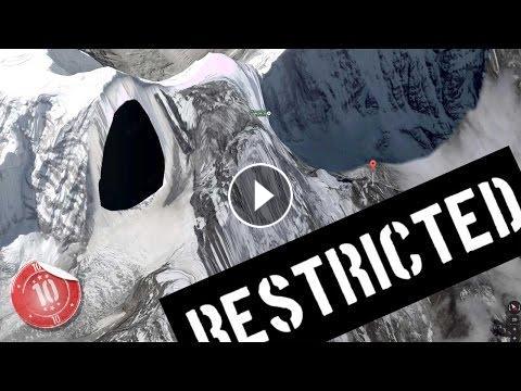
Known colloquially as The Snow Saddle, Kangtega is a major Himalayan mountain peak in Nepal – and a lot of it is obscured on Google Earth. UFO conspiracy theorists claim that the images are hiding the location of a secret UFO testing site, the entrance to which is supposedly hollowed into the side of the Kangtega peak. Take a look for yourself – you decide.
Number 2: HAARP
Located right near Washington-Oregon border, HAARP stands for the High-Frequency Active Auroral Research Program. The facility was setup to study a part of the earth’s atmosphere called the ionosphere – but it was shut down in 2014 by the US Air Force.
Number 1: Colonel Sanders
Yes, we’re talking about THE Colonel – the face of Kentucky Fried Chicken. And you may think we’re joking, but this Google conspiracy runs worldwide.
You see, no matter where you look on Google Street View, anywhere and everywhere in the world, the Colonel’s face is blurred out. It’s true. From the US, to Europe, to Australia, to Asia… the Colonel is nowhere to be seen.
Sorry! Our video editor added the wrong location for number 5! This is where we mean! https://www.google.co.uk/maps/@-19.2559009,159.9283954,45987m/data=!3m1!1e3
► FACEBOOK https://www.facebook.com/dailytop10s
► TWITTER https://twitter.com/daily_top10s
► SUBSCRIBE http://www.youtube.com/channel/UCScswbWVOicLBZwD_6zfXkA?sub_confirmation=1
Thanks for subscribing to DailyTop10s!
In some cases we may use Creative Commons videos which may not have actually carried the right to be Creative Commons due to including copyright content, if you beleive this is the case as your clip is featured in one of our videos, then please contact us.
- Category
- Fly Fishing


